
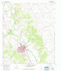
1955 Map of Clifton
USGS Topo · Published 1956About this map
The Bosque River winds through the heart of the Texas hill country, framing the town of Clifton during a period of mid-century growth. The town grid is clearly defined, supporting local institutions like the National Guard Armory, Athletic Field, and Rodeo Grounds. Transportation and industry are centered on the Gulf Colorado and Santa Fe railroad, which parallels the river and serves the nearby Gravel Pit.
Find a feature on this map
23 named features on this map. Tap any name to fly to it.
Don’t see what you’re looking for? This feature index may not catch every label — zoom into the map to look around manually.
Map Details
Editions of this 1955 Clifton Map
2 editions found
Other maps of this area

1888 · Meridian
USGS Topo · 1:125,000

1892 · Waco
USGS Topo · 1:125,000

1894 · Meridian
USGS Topo · 1:125,000

1920 · Waco
USGS Topo · 1:125,000

1924 · Waco 2-b
USGS Topo · 1:48,000

1931 · Whitney
USGS Topo · 1:62,500

1931 · Valley Mills
USGS Topo · 1:62,500

1954 · Waco
USGS Topo · 1:250,000

1955 · Waco
USGS Topo · 1:250,000

1955 · Meridian
USGS Topo · 1:24,000