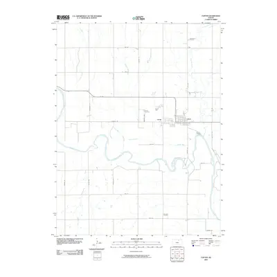
2009 Map of Clifton
USGS Topo · Published 2009About this map
Clifton and the adjacent community of Vining anchor this portion of the northern Kansas landscape, where the meandering course of the Republican River dictates the local geography. The river's broad valley is fed by several tributaries, including Dry Creek and Scribner Creek, which cut through a grid-based road system defined by routes such as Parallel Rd and Meridian Rd. The map reveals a deeply rooted rural layout, with several sites of genealogical interest such as Saint Marys Cemetery to the north and Riverdale Cemetery to the south. This 2009 survey highlights how the established town blocks of Clifton interface with the surrounding agricultural land and the winding waterways of Parsons Creek, providing a clear view of the area's modern spatial organization while preserving the footprints of older family landmarks.
Find a feature on this map
30 named features on this map. Tap any name to fly to it.
Don’t see what you’re looking for? This feature index may not catch every label — zoom into the map to look around manually.
Map Details
Editions of this 2009 Clifton Map
This is the sole edition of this map. No revisions or reprints were ever made.
Other maps of this area

1891 · Clay Center
USGS Topo · 1:125,000

1893 · Washington
USGS Topo · 1:125,000

1955 · Manhattan
USGS Topo · 1:250,000

1956 · Manhattan
USGS Topo · 1:250,000

1957 · Manhattan
USGS Topo · 1:250,000

1964 · Clay Center NW
USGS Topo · 1:24,000

1964 · Miltonvale NE
USGS Topo · 1:24,000

1965 · Clifton
USGS Topo · 1:24,000

1965 · Brantford
USGS Topo · 1:24,000
1965 · Miltonvale NW
USGS Topo · 1:24,000