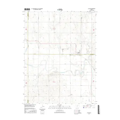
2016 Map of Clifton
USGS Topo · Published 2016About this map
The Republican River carves a winding path across this landscape, defining the topography of a region where Cloud, Washington, and Clay counties meet. The twin communities of Clifton and Vining straddle the county lines, serving as a hub for the surrounding agricultural sections. The map reveals a highly structured grid of local roads, including Parallel Rd and Meridian Rd, which facilitate movement between the dispersed farmsteads of the Kansas prairie. Historical patterns of settlement are anchored by several local burying grounds, notably Saint Mary's Cem to the north and Riverdale Cem to the south. Small watercourses like Scribner Cr, Parsons Cr, and Dry Cr feed into the river basin, while names like Railroad St in Clifton hint at the transit corridors that once fueled the town's growth.
Find a feature on this map
57 named features on this map. Tap any name to fly to it.
Don’t see what you’re looking for? This feature index may not catch every label — zoom into the map to look around manually.
Map Details
Editions of this 2016 Clifton Map
This is the sole edition of this map. No revisions or reprints were ever made.
Other maps of this area

1891 · Clay Center
USGS Topo · 1:125,000

1893 · Washington
USGS Topo · 1:125,000

1955 · Manhattan
USGS Topo · 1:250,000

1956 · Manhattan
USGS Topo · 1:250,000

1957 · Manhattan
USGS Topo · 1:250,000

1964 · Clay Center NW
USGS Topo · 1:24,000

1964 · Miltonvale NE
USGS Topo · 1:24,000

1965 · Clifton
USGS Topo · 1:24,000

1965 · Brantford
USGS Topo · 1:24,000
1965 · Miltonvale NW
USGS Topo · 1:24,000