
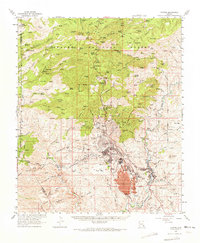
1962 Map of Clifton
USGS Topo · Published 1964About this map
The massive Morenci Open Pit dominates the heart of this early 1960s survey, illustrating the intensive copper mining operations that reshaped the Greenlee County landscape. The industrial network is centered on Morenci and its satellite settlements, including Stargo, Plantsite, and East Plantsite. While Clifton serves as the valley's commercial hub along the Southern Pacific Railroad, the map also documents the older footprints of the district's history, such as the Metcalf (Site) and the Metcalf Cem. To the north, the terrain transitions into the high country of the Apache National Forest, where features like Grey Peak and the Granville Recreation Area sit in stark contrast to the deep excavations of the Coronado Mine and the sprawling Leaching Pond. This edition preserves the location of many springs, such as Webster Spring and Sardine Spring, which supported early regional development.
Find a feature on this map
83 named features on this map. Tap any name to fly to it.
Don’t see what you’re looking for? This feature index may not catch every label — zoom into the map to look around manually.
Map Details
Editions of this 1962 Clifton Map
2 editions found
Other maps of this area

1902 · Clifton
USGS Topo · 1:62,500

1913 · Morenci
USGS Topo · 1:125,000

1915 · Morenci
USGS Topo · 1:125,000

1954 · Silver City
USGS Topo · 1:250,000

1954 · Clifton
USGS Topo · 1:250,000

1957 · Clifton
USGS Topo · 1:250,000

1958 · Silver City
USGS Topo · 1:250,000

1958 · Clifton
USGS Topo · 1:250,000

1959 · York Valley
USGS Topo · 1:62,500

1960 · Guthrie
USGS Topo · 1:62,500