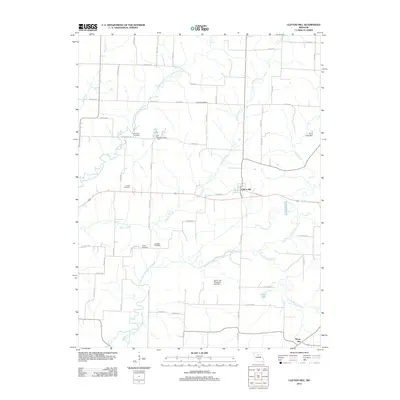
2012 Map of Clifton Hill
USGS Topo · Published 2012About this map
The Middle Fork Little Chariton River and its parallel counterpart, the East Fork Little Chariton River, define the rural landscape around Clifton Hill. This central Missouri region is characterized by a dense network of county roads, such as Peabody Rd and Salisbury Rd, which connect long-standing family farms and small rural settlements. Genealogy and local history are particularly well-represented through several burial sites including Johnson Cemetery, Richardson Cemetery, and Kitchen Cemetery. Human modification of the drainage system is evident in features like the Dan Shepherd Dam on Big Lake and the Quinn and Fitzgerald Lake Dam. To the southeast, the small community of Mount Airy sits near the confluence of local streams and county corridors, illustrating the enduring agricultural patterns of Randolph County.
Find a feature on this map
56 named features on this map. Tap any name to fly to it.
Don’t see what you’re looking for? This feature index may not catch every label — zoom into the map to look around manually.
Map Details
Editions of this 2012 Clifton Hill Map
This is the sole edition of this map. No revisions or reprints were ever made.
Other maps of this area

1890 · Glasgow
USGS Topo · 1:125,000

1953 · Moberly
USGS Topo · 1:250,000

1953 · Huntsville
USGS Topo · 1:24,000

1953 · Higbee
USGS Topo · 1:24,000

1953 · College Mound
USGS Topo · 1:24,000

1953 · Armstrong
USGS Topo · 1:24,000

1953 · Clifton Hill
USGS Topo · 1:24,000

1953 · Prairie Hill
USGS Topo · 1:24,000

1953 · Bynumville
USGS Topo · 1:24,000

1954 · Moberly
USGS Topo · 1:250,000