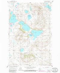
1958 Map of Clifton
USGS Topo · Published 1986About this map
Clifton stands as a small rail-side community in central North Dakota during the late 1950s, situated along the Burlington Northern line. This survey, updated with mid-1980s data, illustrates a landscape dominated by the glacial prairie pothole region, where large bodies of water like Antelope Lake and Lesmeister Lake provide critical habitat. The establishment of the National Waterfowl Production Area (marked frequently as Nwpa) reflects a mid-century commitment to conservation within Pierce County. Outside of the small settlement and the railroad corridor, the terrain is characterized by undulating contours and depressions typical of the Missouri River Basin’s northern reaches. A Gravel Pit located near the tracks suggests the local extraction industry used for rail bed maintenance and road improvements in this agricultural area.
Find a feature on this map
9 named features on this map. Tap any name to fly to it.
Don’t see what you’re looking for? This feature index may not catch every label — zoom into the map to look around manually.
Map Details
Editions of this 1958 Clifton Map
2 editions found
Other maps of this area

1940 · Aylmer
USGS Topo · 1:62,500

1941 · Selz
USGS Topo · 1:62,500
1951 · Harvey
USGS Topo · 1:24,000

1951 · Martin
USGS Topo · 1:24,000

1951 · Anamoose SW
USGS Topo · 1:24,000

1951 · Selz NW
USGS Topo · 1:24,000

1952 · New Rockford
USGS Topo · 1:250,000

1953 · Devils Lake
USGS Topo · 1:250,000

1954 · Minot
USGS Topo · 1:250,000

1954 · McClusky
USGS Topo · 1:250,000