
1951 Map of Clifton
USGS Topo · Published 1953About this map
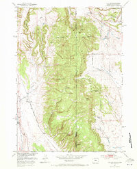
The Clifton settlement and the Chicago Burlington and Quincy railroad line define this 1951 study of the rugged borderland between Weston County, Wyoming, and Custer County, South Dakota. The landscape is dominated by the high elevations of the Elk Mountains and Wildcat Peak, much of which is contained within the Harney National Forest. Local history is reflected in several remote landmarks, including the Clifton School (Aban'd) and the Blaine Ranch, while numerous water sources like Whoopup Creek, Slate Spring, and Dugout Creek indicate the vital importance of water management in this arid terrain. Topography ranges from deep incisions like Rock Canyon and Ferguson Canyon to industrial sites such as the Gravel Pits (Inactive) and an Artesian Well, showing a region transitioning from active rural occupation toward more specialized forestry and resource use.
Find a feature on this map
30 named features on this map. Tap any name to fly to it.
Don’t see what you’re looking for? This feature index may not catch every label — zoom into the map to look around manually.
Map Details
Editions of this 1951 Clifton Map
4 editions found
Other maps of this area

1896 · Harney Peak
USGS Topo · 1:125,000

1899 · Newcastle
USGS Topo · 1:125,000

1901 · Harney Peak
USGS Topo · 1:125,000

1901 · Newcastle
USGS Topo · 1:125,000

1951 · Owens
USGS Topo · 1:24,000

1951 · Dewey
USGS Topo · 1:24,000

1951 · Dewey SW
USGS Topo · 1:24,000

1951 · Newcastle
USGS Topo · 1:24,000

1951 · Fanny Peak
USGS Topo · 1:24,000
1954 · Jewel Cave SW
USGS Topo · 1:24,000