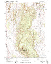
1951 Map of Clifton
USGS Topo · Published 1977About this map
Clifton sits at the southwestern edge of the Black Hills in the early 1950s, serving as a quiet rail and ranching outpost on the border of Wyoming and South Dakota. The Chicago Burlington And Quincy railroad tracks run north to south through the area, following the drainage of Whoopup Creek. While the Clifton School (Aban'd) suggests a shift in the local population centers, the landscape remains defined by the rugged transition from the Elk Mountains down to the plains.
Find a feature on this map
32 named features on this map. Tap any name to fly to it.
Don’t see what you’re looking for? This feature index may not catch every label — zoom into the map to look around manually.
Map Details
Editions of this 1951 Clifton Map
4 editions found
Other maps of this area

1896 · Harney Peak
USGS Topo · 1:125,000

1899 · Newcastle
USGS Topo · 1:125,000

1901 · Harney Peak
USGS Topo · 1:125,000

1901 · Newcastle
USGS Topo · 1:125,000

1951 · Owens
USGS Topo · 1:24,000

1951 · Dewey
USGS Topo · 1:24,000

1951 · Dewey SW
USGS Topo · 1:24,000

1951 · Newcastle
USGS Topo · 1:24,000

1951 · Fanny Peak
USGS Topo · 1:24,000

1951 · Clifton
USGS Topo · 1:24,000