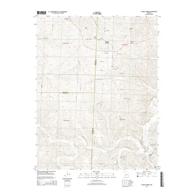
2014 Map of Climax Springs
USGS Topo · Published 2014About this map
Climax Springs sits at a geographic crossroads in the Missouri Ozarks, where the borders of Benton, Camden, and Hickory counties converge. This 2014 survey reveals a landscape defined by the deep drainage systems of the Little Niangua River, which meanders through the southern half of the quadrangle. The terrain is characterized by a series of prominent ridges and secluded hollows, such as Canfield Ridge and Elkenberry Hollow, which have long dictated the placement of local homesteads and travel routes like Drennon Chapel Rd. Local history and genealogy are anchored by several established burial grounds, including Climax Springs Cemetery, Creach Cemetery, and Green Cemetery. The area maintains its rural character with features like Miller Airport providing a small-scale aviation link to the region. The map tracks numerous creeks, including Deer Cr, Indian Cr, and Starks Cr, illustrating the intricate watershed that feeds into the river system.
Find a feature on this map
114 named features on this map. Tap any name to fly to it.
Don’t see what you’re looking for? This feature index may not catch every label — zoom into the map to look around manually.
Map Details
Editions of this 2014 Climax Springs Map
This is the sole edition of this map. No revisions or reprints were ever made.
Other maps of this area

1884 · Bolivar
USGS Topo · 1:125,000

1887 · Warsaw
USGS Topo · 1:125,000

1888 · Versailles
USGS Topo · 1:125,000

1892 · Bolivar
USGS Topo · 1:125,000

1893 · Versailles
USGS Topo · 1:125,000

1894 · Warsaw
USGS Topo · 1:125,000

1934 · Macks Creek
USGS Topo · 1:48,000

1934 · Irontown Ferry
USGS Topo · 1:24,000

1935 · Barnumton
USGS Topo · 1:24,000

1935 · Edwards
USGS Topo · 1:24,000