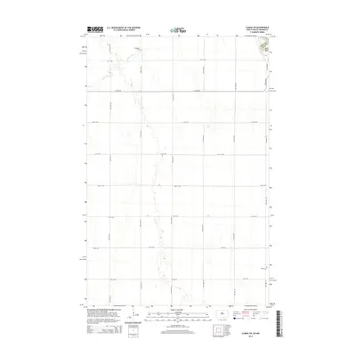
2014 Map of Climax SW
USGS Topo · Published 2014About this map
The flat agricultural plains of the Red River Valley are defined here by a precise grid of rural roads and the subtle path of Buffalo Coulee. This landscape straddles the state line between Minnesota and North Dakota, marking the boundary between Traill County and Polk County. Local history is anchored by a few significant landmarks, including the Hillstead Cem in the north and Salem Cem in the southeast corner. The terrain is remarkably level, typical of the ancient lakebed region, with movement through the area dictated by a network of numbered corridors such as 13th St NE and 172nd Ave NE.
Find a feature on this map
19 named features on this map. Tap any name to fly to it.
Don’t see what you’re looking for? This feature index may not catch every label — zoom into the map to look around manually.
Map Details
Editions of this 2014 Climax SW Map
This is the sole edition of this map. No revisions or reprints were ever made.
Other maps of this area

1918 · Kelso
USGS Topo · 1:62,500

1918 · Hendrum
USGS Topo · 1:62,500

1919 · Eldred
USGS Topo · 1:62,500

1943 · Kelso
USGS Topo · 1:62,500

1952 · Grand Forks
USGS Topo · 1:250,000

1956 · Grand Forks
USGS Topo · 1:250,000

1963 · Shelly
USGS Topo · 1:24,000

1963 · Hillsboro
USGS Topo · 1:24,000

1964 · Climax NW
USGS Topo · 1:24,000

1964 · Climax SW
USGS Topo · 1:24,000