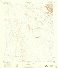
1955 Map of Clint NE
USGS Topo · Published 1959About this map
The Hueco Mountains rise along the northeastern edge of this mid-1950s survey, marking a rugged transition in the El Paso County landscape. Below the peaks, the terrain is defined by isolated elevations such as Backbone Hill and Horse Hill, while human activity is centered on essential water infrastructure. This arid environment required a network of strategic catchment points, visible here as a series of named tanks including Skunk Tank, Lake Tank, and Dugout Tank. Linear utilities cut across the open space, notably the Pipeline Aqueduct and Aqueduct Pipeline, illustrating the critical movement of resources across the desert. Notable landmarks like Gentleman Well and Red Well provide specific points of interest for those tracing land use and grazing patterns in this sparsely settled region during the mid-20th century.
Find a feature on this map
14 named features on this map. Tap any name to fly to it.
Don’t see what you’re looking for? This feature index may not catch every label — zoom into the map to look around manually.
Map Details
Editions of this 1955 Clint NE Map
2 editions found
Other maps of this area

1896 · El Paso
USGS Topo · 1:125,000

1903 · Cerro Alto
USGS Topo · 1:125,000

1908 · El Paso
USGS Topo · 1:125,000

1939 · Heuco Tanks
USGS Topo · 1:62,500

1940 · Heuco Tanks
USGS Topo · 1:62,500

1941 · Clint
USGS Topo · 1:62,500

1941 · Heuco Mountains
USGS Topo · 1:62,500

1942 · Borrego
USGS Topo · 1:62,500

1943 · Heuco Mountains
USGS Topo · 1:62,500

1944 · Heuco Tanks
USGS Topo · 1:62,500