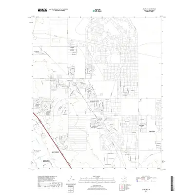
2019 Map of Clint NW
USGS Topo · Published 2019About this map
Horizon City and Socorro anchor this map of the Lower Valley outside El Paso, illustrating the extensive residential expansion and infrastructure of the borderlands. The landscape is defined by its complex irrigation and drainage network, featuring the Mesa Spur Drain, Ysleta Lateral, and Mesa Drain, which speak to the area's agricultural foundations even as modern subdivisions take hold. Numerous residential communities and colonias are visible, including Sparks, Agua Dulce Colonia, and McAdoo Acres Colonia. The map reveals a dense grid of newer street names like Emerald Park Dr and Eastlake Blvd alongside specialized infrastructure such as the El Paso Natural Gas Maint Rd and various aviation-themed lanes like Starduster and Aerocommander near local taxiways. This survey provides an essential look at the late-2010s suburbanization of El Paso County, documenting the specific layout of established neighborhoods and developing settlements.
Find a feature on this map
183 named features on this map. Tap any name to fly to it.
Don’t see what you’re looking for? This feature index may not catch every label — zoom into the map to look around manually.
Map Details
Editions of this 2019 Clint NW Map
This is the sole edition of this map. No revisions or reprints were ever made.
Other maps of this area

1896 · El Paso
USGS Topo · 1:125,000

1908 · El Paso
USGS Topo · 1:125,000

1939 · Ysleta
USGS Topo · 1:62,500

1939 · Heuco Tanks
USGS Topo · 1:62,500

1940 · Heuco Tanks
USGS Topo · 1:62,500

1941 · Clint
USGS Topo · 1:62,500

1941 · Ysleta
USGS Topo · 1:62,500

1942 · Fort Bliss
USGS Topo · 1:62,500

1944 · Heuco Tanks
USGS Topo · 1:62,500

1945 · Ysleta
USGS Topo · 1:62,500
Featured Places
- Socorro, TX
- Horizon City, TX
- Agua Dulce Number 5 Colonia, TX
- Spark's Addition Number 2 Colonia, TX
- Spark's Addition Number 3 Colonia, TX