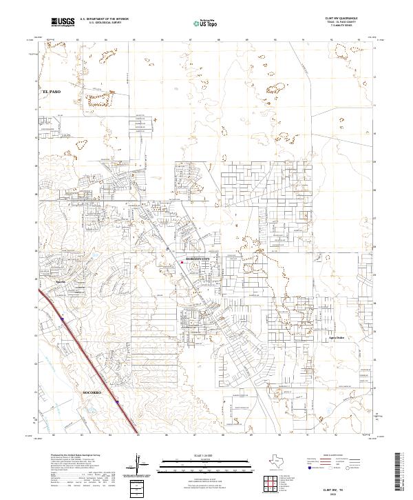
2022 Map of Clint NW
USGS Topo · Published 2022About this map
Horizon City stands as a primary focal point in this 2022 survey, showcasing the modern residential expansion east of the Rio Grande valley. The landscape is defined by its transition from the more established corridor along Gateway Blvd W to the planned suburban grids emerging in the desert. In the western portion, the intricate water management system including the Mesa Spur Drain and Ysleta Lateral reflects the area's agricultural history, even as urban development from El Paso and Socorro moves steadily outward. Further east, the map reveals the distinct layout of Agua Dulce and the smaller community of Sparks, connected by a network of local roads like Pipeline Rd. This survey documents a critical moment of growth where historic drainage canals meet the contemporary street patterns of the growing border region.
Find a feature on this map
195 named features on this map. Tap any name to fly to it.
Don’t see what you’re looking for? This feature index may not catch every label — zoom into the map to look around manually.
Map Details
Editions of this 2022 Clint NW Map
This is the sole edition of this map. No revisions or reprints were ever made.
Other maps of this area

1896 · El Paso
USGS Topo · 1:125,000

1908 · El Paso
USGS Topo · 1:125,000

1939 · Ysleta
USGS Topo · 1:62,500

1939 · Heuco Tanks
USGS Topo · 1:62,500

1940 · Heuco Tanks
USGS Topo · 1:62,500

1941 · Clint
USGS Topo · 1:62,500

1941 · Ysleta
USGS Topo · 1:62,500

1942 · Fort Bliss
USGS Topo · 1:62,500

1944 · Heuco Tanks
USGS Topo · 1:62,500

1945 · Ysleta
USGS Topo · 1:62,500
Featured Places
- Socorro, TX
- Horizon City, TX
- Agua Dulce Number 5 Colonia, TX
- Cochran Mobile Park Colonia, TX
- College Park Addition Colonia, TX