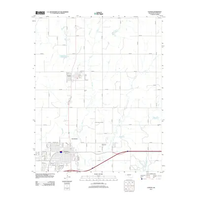
2012 Map of Clinton
USGS Topo · Published 2012About this map
Clinton and the nearby town of Arapaho anchor this 2012 survey, situated along the Washita River in Oklahoma's Custer County. The map provides a detailed view of the regional infrastructure during the early 2010s, showing the grid-like development of Clinton near East Junction and the placement of the Clinton Regional Airport to the north. The landscape is characterized by a series of engineered water management sites, including Beaver Cr Site 4 Reservoir and Bear Cr Site 7 Reservoir, reflecting the area's agricultural and hydrological history.
Find a feature on this map
81 named features on this map. Tap any name to fly to it.
Don’t see what you’re looking for? This feature index may not catch every label — zoom into the map to look around manually.
Map Details
Editions of this 2012 Clinton Map
This is the sole edition of this map. No revisions or reprints were ever made.
Other maps of this area

1955 · Clinton
USGS Topo · 1:250,000

1956 · Cordell
USGS Topo · 1:62,500

1957 · Clinton
USGS Topo · 1:250,000

1957 · Butler
USGS Topo · 1:62,500

1957 · Clinton
USGS Topo · 1:62,500

1957 · Dill City
USGS Topo · 1:62,500

1976 · Clinton SE
USGS Topo · 1:24,000

1976 · Butler NE
USGS Topo · 1:24,000

1976 · Clinton SW
USGS Topo · 1:24,000

1976 · Clinton NW
USGS Topo · 1:24,000