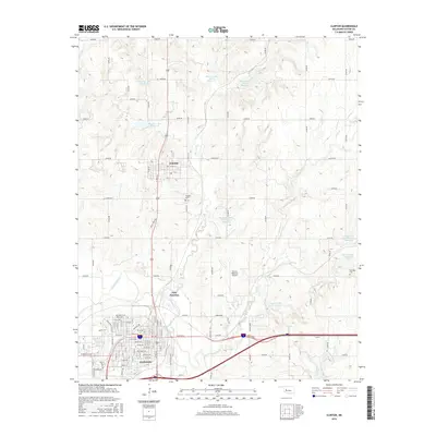
2016 Map of Clinton
USGS Topo · Published 2016About this map
The Washita River carves a path through this Western Oklahoma landscape, defining the topography between the city of Clinton and the town of Arapaho. This 2016 survey shows a region characterized by a highly managed watershed, featuring numerous flood control structures such as Beaver Creek Site 10 Reservoir and Rainy Mountain Creek Site 35 Reservoir. The street grid of Clinton is documented in detail, showing major thoroughfares like Frisco Ave and Gary Blvd, alongside established local landmarks like the Clinton Regional Airport. Genealogists and local historians can locate the Arapaho Cem and Red Rock Cem, while the inclusion of East Junction provides context for the area's transportation network near Beaver Cr. The map's layout highlights the transition from urban residential blocks to the surrounding agricultural and creek-cut terrain.
Find a feature on this map
51 named features on this map. Tap any name to fly to it.
Don’t see what you’re looking for? This feature index may not catch every label — zoom into the map to look around manually.
Map Details
Editions of this 2016 Clinton Map
This is the sole edition of this map. No revisions or reprints were ever made.
Other maps of this area

1955 · Clinton
USGS Topo · 1:250,000

1956 · Cordell
USGS Topo · 1:62,500

1957 · Clinton
USGS Topo · 1:250,000

1957 · Butler
USGS Topo · 1:62,500

1957 · Clinton
USGS Topo · 1:62,500

1957 · Dill City
USGS Topo · 1:62,500

1976 · Clinton SE
USGS Topo · 1:24,000

1976 · Butler NE
USGS Topo · 1:24,000

1976 · Clinton SW
USGS Topo · 1:24,000

1976 · Clinton NW
USGS Topo · 1:24,000