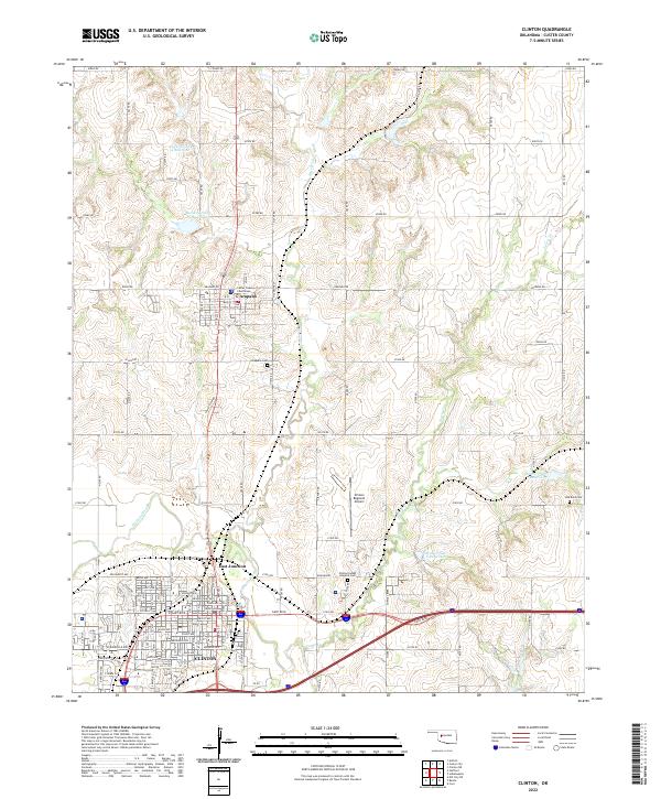
2022 Map of Clinton
USGS Topo · Published 2022About this map
Clinton and the county seat of Arapaho anchor this landscape along the Washita River valley. The map documents the civic and logistical layout of the region, from the Custer County Courthouse in Arapaho to the extensive street grid of Clinton, which includes thoroughfares like Gary Blvd and Modelle Ave. This area is characterized by a sophisticated water management system, illustrated by numerous numbered reservoirs such as Beaver Cr Site 4 Reservoir and Bear Cr Site 6 Reservoir situated along Beaver Cr and Turtle Creek. These features indicate the region's reliance on controlled water resources for the surrounding agricultural plains. Local history researchers will find significant value in the distribution of burial sites, including the Arapaho Cem, Red Rock Cem, and the Clinton Indian Hospital Cem, which offer physical links to the community's ancestral heritage.
Find a feature on this map
47 named features on this map. Tap any name to fly to it.
Don’t see what you’re looking for? This feature index may not catch every label — zoom into the map to look around manually.
Map Details
Editions of this 2022 Clinton Map
This is the sole edition of this map. No revisions or reprints were ever made.
Other maps of this area

1955 · Clinton
USGS Topo · 1:250,000

1956 · Cordell
USGS Topo · 1:62,500

1957 · Clinton
USGS Topo · 1:250,000

1957 · Butler
USGS Topo · 1:62,500

1957 · Clinton
USGS Topo · 1:62,500

1957 · Dill City
USGS Topo · 1:62,500

1976 · Clinton SE
USGS Topo · 1:24,000

1976 · Butler NE
USGS Topo · 1:24,000

1976 · Clinton SW
USGS Topo · 1:24,000

1976 · Clinton NW
USGS Topo · 1:24,000