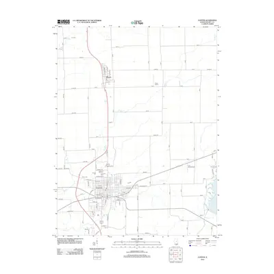
2012 Map of Clinton
USGS Topo · Published 2012About this map
The city of Clinton serves as the central hub of this 2012 survey, showing a well-established grid of residential streets and the primary commercial district. Several cemeteries, including Woodlawn Cem, Oak Park Cem, and Memorial Park Cem, ring the northwestern edge of the city, providing a significant footprint for local family researchers. North of the city, the smaller village of Wapella is situated along the highway and railway corridor, surrounded by the geometric section-line roads characteristic of the Illinois prairie.
Find a feature on this map
52 named features on this map. Tap any name to fly to it.
Don’t see what you’re looking for? This feature index may not catch every label — zoom into the map to look around manually.
Map Details
Editions of this 2012 Clinton Map
This is the sole edition of this map. No revisions or reprints were ever made.
Other maps of this area

1949 · Mc Lean
USGS Topo · 1:62,500

1951 · McLean
USGS Topo · 1:62,500

1951 · Le Roy
USGS Topo · 1:62,500

1957 · Kenney
USGS Topo · 1:62,500

1957 · Maroa
USGS Topo · 1:62,500

1958 · Peoria
USGS Topo · 1:250,000

1961 · Peoria
USGS Topo · 1:250,000

1963 · Peoria
USGS Topo · 1:250,000
1979 · Maroa
USGS Topo · 1:24,000

1979 · De Witt
USGS Topo · 1:24,000