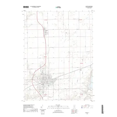
2018 Map of Clinton
USGS Topo · Published 2018About this map
The city of Clinton serves as the focal point of this DeWitt County landscape, positioned where the regional road network converges amidst fertile agricultural land. The dense street grid of the city, featuring names like N Walnut St and E Main St, transitions into a cluster of memorial sites on the northern edge, including Memorial Park Cem, Woodlawn Cem, and Oak Park Cem. To the north, the smaller village of Wapella sits along the rail line, while private aviation is represented by Thorp Airport and John Scharff Airport. The natural geography is defined by the winding course of Tenmile Cr and Coon Cr, both of which feed toward the southeast corner where Lake Clinton and Salt Creek dominate the terrain. This survey illustrates a modern Midwestern landscape where historical burial grounds like Crum Cem and Weaver Cem remain preserved among active transport corridors and expanded water resources.
Find a feature on this map
70 named features on this map. Tap any name to fly to it.
Don’t see what you’re looking for? This feature index may not catch every label — zoom into the map to look around manually.
Map Details
Editions of this 2018 Clinton Map
This is the sole edition of this map. No revisions or reprints were ever made.
Other maps of this area

1949 · Mc Lean
USGS Topo · 1:62,500

1951 · McLean
USGS Topo · 1:62,500

1951 · Le Roy
USGS Topo · 1:62,500

1957 · Kenney
USGS Topo · 1:62,500

1957 · Maroa
USGS Topo · 1:62,500

1958 · Peoria
USGS Topo · 1:250,000

1961 · Peoria
USGS Topo · 1:250,000

1963 · Peoria
USGS Topo · 1:250,000
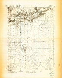
1979 · Maroa
USGS Topo · 1:24,000

1979 · De Witt
USGS Topo · 1:24,000