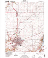
1999 Map of Clinton
USGS Topo · Published 2001About this map
Clinton serves as the central hub of this De Witt County landscape, showcasing a dense grid of residential and civic life at the close of the twentieth century. The map documents the town's core infrastructure, including the Courthouse, City Hall, and Warner Hosp, alongside educational landmarks like Washington Sch and Community High Sch. This era reflects a established agricultural and recreational community, where the expansive Weldon Springs State Park and the waters of Lake Clinton dominate the southeastern corner, contrasting with the smaller settlement of Wapella to the north.
Find a feature on this map
27 named features on this map. Tap any name to fly to it.
Don’t see what you’re looking for? This feature index may not catch every label — zoom into the map to look around manually.
Map Details
Editions of this 1999 Clinton Map
This is the sole edition of this map. No revisions or reprints were ever made.
Other maps of this area

1949 · Mc Lean
USGS Topo · 1:62,500

1951 · McLean
USGS Topo · 1:62,500

1951 · Le Roy
USGS Topo · 1:62,500

1957 · Kenney
USGS Topo · 1:62,500

1957 · Maroa
USGS Topo · 1:62,500

1958 · Peoria
USGS Topo · 1:250,000

1961 · Peoria
USGS Topo · 1:250,000

1963 · Peoria
USGS Topo · 1:250,000
1979 · Maroa
USGS Topo · 1:24,000

1979 · De Witt
USGS Topo · 1:24,000