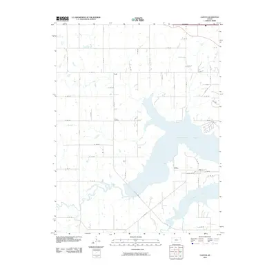
2010 Map of Clinton
USGS Topo · Published 2010About this map
Clinton Lake dominates this 2010 landscape, its expansive waters filling the valley where the Wakarusa River once flowed unimpeded. The settlement of Clinton sits near the eastern shore, while the community of Stull remains positioned further north among the grid of rural township roads. This survey illustrates the modern configuration of the reservoir and its surrounding recreation areas, which fundamentally altered the drainage patterns of several local tributaries, including Deer Creek, Dry Creek, and Coon Creek.
Find a feature on this map
33 named features on this map. Tap any name to fly to it.
Don’t see what you’re looking for? This feature index may not catch every label — zoom into the map to look around manually.
Map Details
Editions of this 2010 Clinton Map
This is the sole edition of this map. No revisions or reprints were ever made.
Other maps of this area

1885 · Lawrence
USGS Topo · 1:125,000

1886 · Oskaloosa
USGS Topo · 1:125,000

1888 · Oskaloosa
USGS Topo · 1:125,000

1889 · Burlingame
USGS Topo · 1:125,000

1889 · Topeka
USGS Topo · 1:125,000

1889 · Lawrence
USGS Topo · 1:125,000

1894 · Burlingame
USGS Topo · 1:125,000

1894 · Oskaloosa
USGS Topo · 1:125,000

1894 · Topeka
USGS Topo · 1:125,000

1947 · Lawrence
USGS Topo · 1:250,000