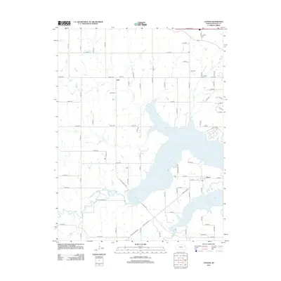
2012 Map of Clinton
USGS Topo · Published 2012About this map
Clinton Lake dominates the central landscape of this western Douglas County region, a massive reservoir created by the damming of the Wakarusa River. The surrounding topography is defined by the drainage basins of Deer Cr, Coon Cr, and Elk Cr, which feed into the lake's various arms. Settlement patterns here are concentrated around the unincorporated communities of Stull to the north and Clinton to the southeast, both of which serve as focal points for the rural road network. The map reveals a high concentration of burial sites, including the widely known Stull Cem, along with Mound Cem and Clinton Cem, providing essential reference points for genealogists. Much of the shoreline and southern terrain is dedicated to recreation and conservation within Clinton State Park, showing the 21st-century transition of this river valley from purely agricultural use to a significant regional water resource and parkland.
Find a feature on this map
69 named features on this map. Tap any name to fly to it.
Don’t see what you’re looking for? This feature index may not catch every label — zoom into the map to look around manually.
Map Details
Editions of this 2012 Clinton Map
This is the sole edition of this map. No revisions or reprints were ever made.
Other maps of this area

1885 · Lawrence
USGS Topo · 1:125,000

1886 · Oskaloosa
USGS Topo · 1:125,000

1888 · Oskaloosa
USGS Topo · 1:125,000

1889 · Burlingame
USGS Topo · 1:125,000

1889 · Topeka
USGS Topo · 1:125,000

1889 · Lawrence
USGS Topo · 1:125,000

1894 · Burlingame
USGS Topo · 1:125,000

1894 · Oskaloosa
USGS Topo · 1:125,000

1894 · Topeka
USGS Topo · 1:125,000

1947 · Lawrence
USGS Topo · 1:250,000