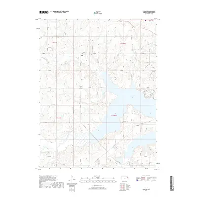
2018 Map of Clinton
USGS Topo · Published 2018About this map
Clinton and Stull anchor this documentation of Douglas County’s evolving landscape, defined by the large reservoir footprint of Clinton Lake. The terrain is deeply etched by the winding course of the Wakarusa River in the south and the dendritic drainage patterns of Deer Cr and Dry Cr that feed into the lake. This 2018 survey captures the intersection of historical rural settlements with modern infrastructure, including the northern edge of the Kansas Tpke. For those tracing local roots, several family and community landmarks are clearly identified, such as the Stull Cem, Mound View Cem, and Clinton Cem. The map illustrates how traditional farm-to-market roads like Co Rd 1023 and N 1500 Rd navigate the complex topography created by the lake’s many inlets, showcasing the enduring relationship between the valley's hydrology and its road network.
Find a feature on this map
65 named features on this map. Tap any name to fly to it.
Don’t see what you’re looking for? This feature index may not catch every label — zoom into the map to look around manually.
Map Details
Editions of this 2018 Clinton Map
This is the sole edition of this map. No revisions or reprints were ever made.
Other maps of this area

1885 · Lawrence
USGS Topo · 1:125,000

1886 · Oskaloosa
USGS Topo · 1:125,000

1888 · Oskaloosa
USGS Topo · 1:125,000

1889 · Burlingame
USGS Topo · 1:125,000

1889 · Topeka
USGS Topo · 1:125,000

1889 · Lawrence
USGS Topo · 1:125,000

1894 · Burlingame
USGS Topo · 1:125,000

1894 · Oskaloosa
USGS Topo · 1:125,000

1894 · Topeka
USGS Topo · 1:125,000

1947 · Lawrence
USGS Topo · 1:250,000