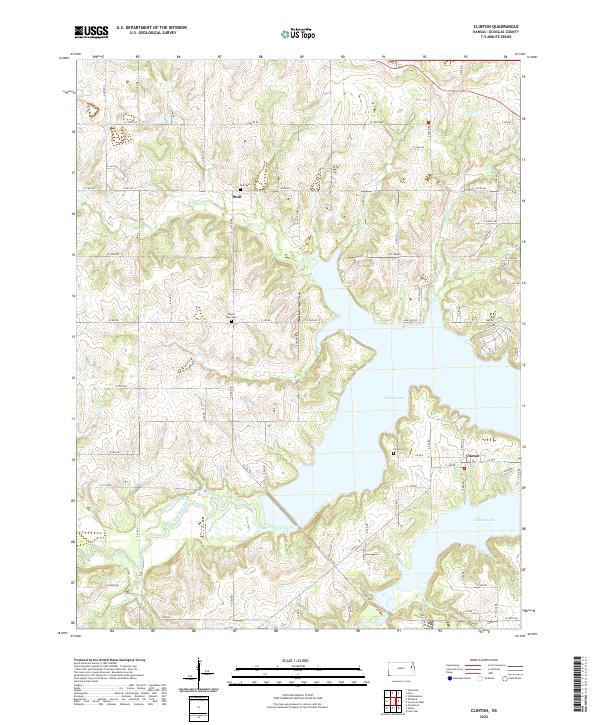
2022 Map of Clinton
USGS Topo · Published 2022About this map
Clinton Lake dominates the central topography of this contemporary Kansas survey, a massive impoundment of the Wakarusa River that has fundamentally reshaped the local environment. The small settlements of Stull and Clinton sit on the periphery of the water, preserving the rural character of Douglas County. This map is particularly valuable for genealogists, as it meticulously identifies several local burial grounds including Stull Cem, Mound View Cem, and Clinton Cem. The landscape is defined by the winding paths of Deer Cr, Dry Cr, and Coon Cr, which feed into the lake through a network of rolling hills. The road system, characterized by a grid of numbered county routes like N 1700TH Rd and E 50th Rd, provides clear access points to the various arms and inlets of the reservoir.
Find a feature on this map
51 named features on this map. Tap any name to fly to it.
Don’t see what you’re looking for? This feature index may not catch every label — zoom into the map to look around manually.
Map Details
Editions of this 2022 Clinton Map
This is the sole edition of this map. No revisions or reprints were ever made.
Other maps of this area

1885 · Lawrence
USGS Topo · 1:125,000

1886 · Oskaloosa
USGS Topo · 1:125,000

1888 · Oskaloosa
USGS Topo · 1:125,000

1889 · Burlingame
USGS Topo · 1:125,000

1889 · Topeka
USGS Topo · 1:125,000

1889 · Lawrence
USGS Topo · 1:125,000

1894 · Burlingame
USGS Topo · 1:125,000

1894 · Oskaloosa
USGS Topo · 1:125,000

1894 · Topeka
USGS Topo · 1:125,000

1947 · Lawrence
USGS Topo · 1:250,000