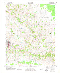
1977 Map of Clinton
USGS Topo · Published 1977About this map
Clinton serves as the focal point of this West Kentucky landscape, where the Illinois Central Gulf railroad cuts through the western edge of the community. The town's layout is centered around its civic and educational heart, featuring a prominent High Sch and several substations that point to the mid-century infrastructure of Hickman County. To the east and north, the terrain transitions into a more rural pattern of scattered settlements like Spring Hill, New Cypress, and Old Cypress, which are linked by a network of local roads crossing numerous waterways such as Cane Creek and Brush Creek.
Find a feature on this map
32 named features on this map. Tap any name to fly to it.
Don’t see what you’re looking for? This feature index may not catch every label — zoom into the map to look around manually.
Map Details
Editions of this 1977 Clinton Map
2 editions found
Other maps of this area

1939 · Wickliffe
USGS Topo · 1:62,500

1939 · Hickman
USGS Topo · 1:62,500

1951 · Cayce
USGS Topo · 1:24,000

1951 · Oakton
USGS Topo · 1:24,000

1951 · Arlington
USGS Topo · 1:24,000

1951 · Milburn
USGS Topo · 1:24,000

1952 · Clinton
USGS Topo · 1:24,000

1952 · Dublin
USGS Topo · 1:24,000

1952 · Crutchfield
USGS Topo · 1:24,000

1952 · Fancy Farm
USGS Topo · 1:24,000