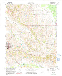
1977 Map of Clinton
USGS Topo · Published 1991About this map
The town of Clinton serves as the focal point of this western Kentucky landscape, situated along the Illinois Central Gulf railroad line. The settlement pattern here is defined by small rural clusters and family landmarks, with New Cypress and Old Cypress to the north and several country churches anchoring the community. The topography is shaped by the winding course of Cane Creek and the southern marshlands of Bayou de Chien, where a Gaging Station monitors the water flow. Genealogists will find significant value in the distribution of family-named burial grounds like McWhort Cem and Vivrett Cem, alongside several houses of worship including Mt Moriah Ch and Trinity Chapel. The presence of a Lookout Tower and various substations reflects the mid-century infrastructure supporting this agrarian region.
Find a feature on this map
31 named features on this map. Tap any name to fly to it.
Don’t see what you’re looking for? This feature index may not catch every label — zoom into the map to look around manually.
Map Details
Editions of this 1977 Clinton Map
2 editions found
Other maps of this area

1939 · Wickliffe
USGS Topo · 1:62,500

1939 · Hickman
USGS Topo · 1:62,500

1951 · Cayce
USGS Topo · 1:24,000

1951 · Oakton
USGS Topo · 1:24,000

1951 · Arlington
USGS Topo · 1:24,000

1951 · Milburn
USGS Topo · 1:24,000

1952 · Clinton
USGS Topo · 1:24,000

1952 · Dublin
USGS Topo · 1:24,000

1952 · Crutchfield
USGS Topo · 1:24,000

1952 · Fancy Farm
USGS Topo · 1:24,000