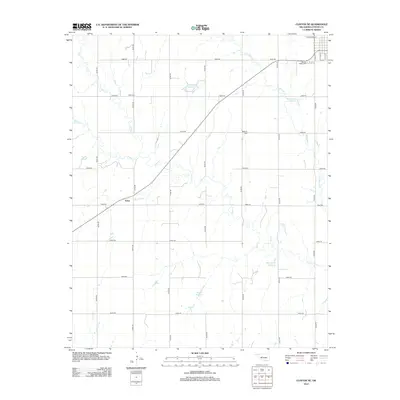
2012 Map of Clinton NE
USGS Topo · Published 2012About this map
The agrarian landscape of Custer County, Oklahoma, is defined by the drainage basins of Deer Cr and Little Deer Cr, which slice through a strictly gridded road network. In the early 21st century, this rural expanse is anchored by the small settlement of Foley and several family-named water features, including Woldridge Reservoir and Bob Decker Reservoir. These private impoundments suggest the continued importance of water management for local ranching and agriculture. For those tracing family histories, the map preserves the locations of vital community landmarks such as Mound Valley Cem, Beck Cem, and Bethany Cem. The street layout in the northeast corner shows the southern fringes of a larger town, where roads like W Johnson St and S 15th St meet the rural section lines.
Find a feature on this map
32 named features on this map. Tap any name to fly to it.
Don’t see what you’re looking for? This feature index may not catch every label — zoom into the map to look around manually.
Map Details
Editions of this 2012 Clinton NE Map
This is the sole edition of this map. No revisions or reprints were ever made.
Other maps of this area

1955 · Clinton
USGS Topo · 1:250,000

1957 · Clinton
USGS Topo · 1:250,000

1957 · Clinton
USGS Topo · 1:62,500

1962 · Putnam
USGS Topo · 1:62,500

1964 · Oakwood
USGS Topo · 1:62,500

1964 · Weatherford
USGS Topo · 1:62,500

1976 · Clinton SE
USGS Topo · 1:24,000

1976 · Clinton SW
USGS Topo · 1:24,000

1976 · Clinton NW
USGS Topo · 1:24,000

1976 · Clinton NE
USGS Topo · 1:24,000