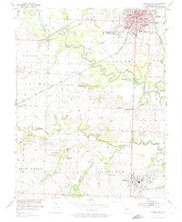
1953 Map of Clinton South
USGS Topo · Published 1974About this map
The South Grand River meanders across the landscape north of Clinton, defining a region where river bottomlands meet industrial development. During the early 1950s, the area's economy was anchored by a robust transportation network including the Missouri Kansas Texas and St Louis San Francisco railroads. While Clinton serves as the primary municipal hub with its City Hall and numerous schools like Franklin Sch and Washington Sch, the southern portion of the map reveals a shift toward heavy industry. Extractive operations such as the Hilty Mine, Johnson Mine, and various Strip Mine sites around Deepwater indicate the importance of coal to the local economy. Rural life is well-documented through scattered landmarks, including Golden Gate Ch and the Dunning Cem, alongside several one-room schoolhouses like Independence Sch and Lime Sch.
Find a feature on this map
36 named features on this map. Tap any name to fly to it.
Don’t see what you’re looking for? This feature index may not catch every label — zoom into the map to look around manually.
Map Details
Editions of this 1953 Clinton South Map
3 editions found
Other maps of this area

1887 · Clinton
USGS Topo · 1:125,000

1894 · Clinton
USGS Topo · 1:125,000

1941 · Lowry City
USGS Topo · 1:24,000

1945 · Lowry City
USGS Topo · 1:24,000

1947 · Jefferson City
USGS Topo · 1:250,000

1953 · Gaines
USGS Topo · 1:24,000

1953 · Montrose
USGS Topo · 1:24,000

1953 · Hartwell
USGS Topo · 1:24,000

1953 · Clinton South
USGS Topo · 1:24,000

1953 · Calhoun West
USGS Topo · 1:24,000