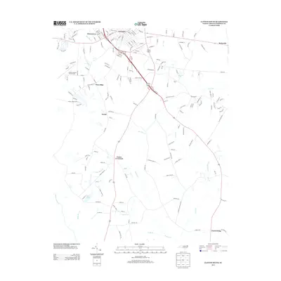
2013 Map of Clinton South
USGS Topo · Published 2013About this map
Clinton serves as the focal point for this section of Sampson County, where the urban grid gives way to a network of rural communities and named crossroads. The landscape is defined by the winding paths of Great Coharie Cr and its many tributaries, including Buckhorn Cr and Rocky Marsh Cr, which historically dictated the placement of early settlements and mills. Local industry and transit are represented by the Clinton-Sampson County Airport and the Clinton Lookout Tower, while smaller rural nodes like Butlers Crossroads and Taylors Bridge mark the intersection of farming life and regional commerce. The presence of features like Royal Mill Br and Wolf Pit Br points to a landscape deeply integrated with its hydraulic features, which have long supported the agrarian economy of the Coastal Plain.
Find a feature on this map
165 named features on this map. Tap any name to fly to it.
Don’t see what you’re looking for? This feature index may not catch every label — zoom into the map to look around manually.
Map Details
Editions of this 2013 Clinton South Map
This is the sole edition of this map. No revisions or reprints were ever made.
Other maps of this area

1909 · Coharie
USGS Topo · 1:62,500

1953 · Florence
USGS Topo · 1:250,000

1953 · Raleigh
USGS Topo · 1:250,000

1954 · Florence
USGS Topo · 1:250,000

1954 · Raleigh
USGS Topo · 1:250,000

1959 · Garland
USGS Topo · 1:62,500

1962 · Rose Hill
USGS Topo · 1:62,500

1975 · Faison
USGS Topo · 1:24,000

1982 · Elizabethtown
USGS Topo · 1:100,000
1984 · Delway
USGS Topo · 1:24,000