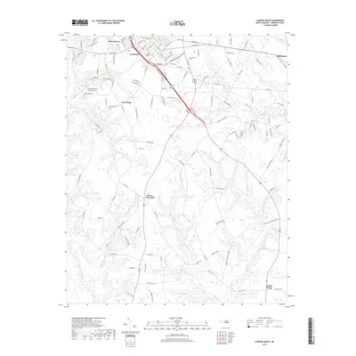
2019 Map of Clinton South
USGS Topo · Published 2019About this map
Clinton serves as the focal point for this 2019 survey of central Sampson County, where urban expansion meets the agricultural heartland of the Coastal Plain. The landscape is defined by a dense network of blackwater streams, including Great Coharie Creek and its many tributaries like Buckhorn Cr and Wolf Pit Br. To the south and west of the city center, small rural communities and named crossroads such as Butlers Crossroads and Piney Ridge mark the transition into the countryside. Significant local landmarks include Springdale Cem and the Clinton-Sampson County Airport, which stand alongside a complex road system that includes the bypass-style routing of modern highways. The presence of Best Pond and Chestnut Pond further illustrates the low-lying, water-rich nature of the terrain surrounding Johnsontown and Taylors Bridge.
Find a feature on this map
123 named features on this map. Tap any name to fly to it.
Don’t see what you’re looking for? This feature index may not catch every label — zoom into the map to look around manually.
Map Details
Editions of this 2019 Clinton South Map
This is the sole edition of this map. No revisions or reprints were ever made.
Other maps of this area

1909 · Coharie
USGS Topo · 1:62,500

1953 · Florence
USGS Topo · 1:250,000

1953 · Raleigh
USGS Topo · 1:250,000

1954 · Florence
USGS Topo · 1:250,000

1954 · Raleigh
USGS Topo · 1:250,000

1959 · Garland
USGS Topo · 1:62,500

1962 · Rose Hill
USGS Topo · 1:62,500

1975 · Faison
USGS Topo · 1:24,000

1982 · Elizabethtown
USGS Topo · 1:100,000
1984 · Delway
USGS Topo · 1:24,000