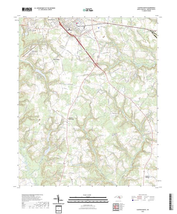
2022 Map of Clinton South
USGS Topo · Published 2022About this map
Clinton serves as the regional hub of this landscape, where the Sampson County Courthouse anchors the historic center. The surrounding area is characterized by a dense network of watercourses that shaped early settlement patterns, including the winding Great Coharie Creek and its many tributaries like Rocky Marsh Creek and Jumpand Run Brs. Small rural communities such as Johnsontown, Piney Ridge, and Butlers Crossroads are scattered throughout the territory, connected by a web of local roads named for established local families, including Mattie Byrd Ln and Clive Jacobs Rd. The presence of the Clinton-Sampson County Airport and Sampson Community College indicates the area's continued role as a center for infrastructure and education in the modern era, while the Springdale Cem offers a point of interest for genealogical research.
Find a feature on this map
118 named features on this map. Tap any name to fly to it.
Don’t see what you’re looking for? This feature index may not catch every label — zoom into the map to look around manually.
Map Details
Editions of this 2022 Clinton South Map
This is the sole edition of this map. No revisions or reprints were ever made.
Other maps of this area

1909 · Coharie
USGS Topo · 1:62,500

1953 · Florence
USGS Topo · 1:250,000

1953 · Raleigh
USGS Topo · 1:250,000

1954 · Florence
USGS Topo · 1:250,000

1954 · Raleigh
USGS Topo · 1:250,000

1959 · Garland
USGS Topo · 1:62,500

1962 · Rose Hill
USGS Topo · 1:62,500

1975 · Faison
USGS Topo · 1:24,000

1982 · Elizabethtown
USGS Topo · 1:100,000
1984 · Delway
USGS Topo · 1:24,000