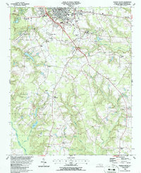
1986 Map of Clinton South
USGS Topo · Published 1986About this map
Clinton serves as the focal point for this mid-1980s survey of southern Sampson County, where the urban grid meets the agricultural reaches of coastal North Carolina. The landscape is defined by the branching waters of the Great Coharie Creek and its many tributaries like Crane Creek and Buckhorn Creek, which carve through the terrain and influence local settlement patterns. Important local institutions are prominently featured, including Sampson College and the Sampson County Airport, reflecting the area's development as an educational and logistical hub.
Find a feature on this map
47 named features on this map. Tap any name to fly to it.
Don’t see what you’re looking for? This feature index may not catch every label — zoom into the map to look around manually.
Map Details
Editions of this 1986 Clinton South Map
This is the sole edition of this map. No revisions or reprints were ever made.
Other maps of this area

1909 · Coharie
USGS Topo · 1:62,500

1953 · Florence
USGS Topo · 1:250,000

1953 · Raleigh
USGS Topo · 1:250,000

1954 · Florence
USGS Topo · 1:250,000

1954 · Raleigh
USGS Topo · 1:250,000

1959 · Garland
USGS Topo · 1:62,500

1962 · Rose Hill
USGS Topo · 1:62,500

1975 · Faison
USGS Topo · 1:24,000

1982 · Elizabethtown
USGS Topo · 1:100,000
1984 · Delway
USGS Topo · 1:24,000