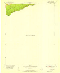
1954 Map of Clintwood
USGS Topo · Published 1955About this map
Pine Mountain forms a dramatic topographic boundary in this mid-century survey, marking the jagged interstate line where Kentucky and Virginia meet. The map reveals a series of natural high-altitude passes that historically dictated movement through the Cumberland plateau, including Blowing Rock Gap, Jesse Gap, and Grassy Gap. These gaps provided critical passage for travelers and early settlers navigating the steep elevations between Pike County and Dickenson County. Below the ridge line, the drainage patterns of Elkhorn Creek, Pigeon Branch, and Toms Branch illustrate the deeply dissected nature of the terrain. The inclusion of mapping data from the Consolidated Coal Company in the margin notes reflects the industrial importance of this geography, highlighting the connection between the region's complex geology and its coal-producing economy during the early 1950s.
Find a feature on this map
11 named features on this map. Tap any name to fly to it.
Don’t see what you’re looking for? This feature index may not catch every label — zoom into the map to look around manually.
Map Details
Editions of this 1954 Clintwood Map
2 editions found
Other maps of this area

1886 · Grundy
USGS Topo · 1:125,000

1890 · Whitesburg
USGS Topo · 1:125,000

1890 · Grundy
USGS Topo · 1:125,000

1892 · Grundy
USGS Topo · 1:125,000

1892 · Whitesburg
USGS Topo · 1:125,000

1912 · Pound
USGS Topo · 1:48,000

1913 · Clintwood
USGS Topo · 1:62,500

1914 · Pound
USGS Topo · 1:62,500

1914 · Vergie
USGS Topo · 1:48,000

1915 · Clintwood
USGS Topo · 1:62,500