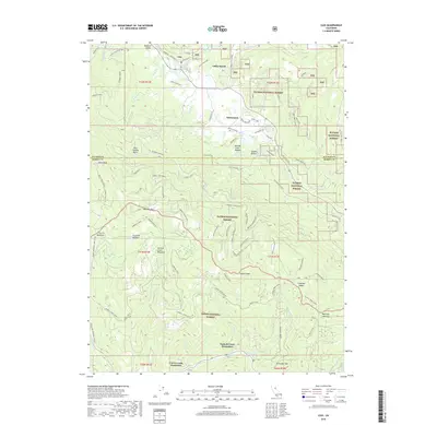
2018 Map of Clio
USGS Topo · Published 2018About this map
The Mohawk Valley landscape is defined by the transition between the Plumas National Forest and Tahoe National Forest. The settlement of Clio sits at the north, connected by River Rd Upper Main and Lower Main St to smaller residential clusters like Valley Ranch and Whitehawk. The terrain is high and complex, featuring Haskell Peak and Millis Peak Lookout, which provide vantage points over the numerous meadows such as Bear Wallow Basin and Freeman Meadow.
Find a feature on this map
78 named features on this map. Tap any name to fly to it.
Don’t see what you’re looking for? This feature index may not catch every label — zoom into the map to look around manually.
Map Details
Editions of this 2018 Clio Map
This is the sole edition of this map. No revisions or reprints were ever made.
Other maps of this area

1890 · Sierraville
USGS Topo · 1:125,000

1891 · Downieville
USGS Topo · 1:125,000

1892 · Sierraville
USGS Topo · 1:125,000

1893 · Downieville
USGS Topo · 1:125,000

1894 · Sierraville
USGS Topo · 1:125,000

1895 · Downieville
USGS Topo · 1:125,000

1896 · Downieville
USGS Topo · 1:125,000

1897 · Downieville
USGS Topo · 1:125,000

1937 · Blairsden
USGS Topo · 1:48,000

1943 · Blairsden
USGS Topo · 1:62,500