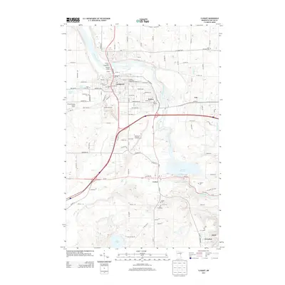
2013 Map of Cloquet
USGS Topo · Published 2013About this map
Saint Louis River dominates this landscape, winding through the industrial and residential heart of Cloquet and passing Dunlap Island before reaching the Thomson Reservoir. The 2013 survey illustrates the dense concentration of civil infrastructure and community history in the region, particularly visible through the cluster of burial grounds such as Hillcrest Cem, Calvary Cem, and New Calvary Cem near the city center. The integration of educational and natural spaces is evident with the Fond Du Lac Tribal And Community Coll situated north of Carlton, while the eastern edge of the map transitions into the preserved acreage of Jay Cooke State Park. Transportation corridors like MN-33 and MN-210 link the settlements of Scanlon, Esko, and Wrenshall, reflecting the modern logistical importance of this river-valley corridor.
Find a feature on this map
123 named features on this map. Tap any name to fly to it.
Don’t see what you’re looking for? This feature index may not catch every label — zoom into the map to look around manually.
Map Details
Editions of this 2013 Cloquet Map
This is the sole edition of this map. No revisions or reprints were ever made.
Other maps of this area

1953 · Saginaw
USGS Topo · 1:24,000

1953 · Adolph
USGS Topo · 1:24,000

1953 · Brookston
USGS Topo · 1:24,000

1953 · Duluth
USGS Topo · 1:250,000

1954 · Cloquet
USGS Topo · 1:24,000

1954 · Wrenshall
USGS Topo · 1:24,000

1954 · Frogner
USGS Topo · 1:24,000

1954 · Atkinson
USGS Topo · 1:24,000

1954 · Esko
USGS Topo · 1:24,000

1954 · Iverson
USGS Topo · 1:24,000