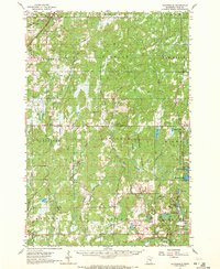
1962 Map of Cloverdale
USGS Topo · Published 1972About this map
The Burlington Northern railroad corridor cuts through the northwestern corner of this Pine County landscape, connecting the rural townships of Norman and Partridge. This 1962 survey reveals a region defined by extensive timberlands and water, anchored by the D A R Memorial State Forest and Nemadji State Forest. Small settlements like Cloverdale and Duxbury serve as local hubs for the surrounding farmsteads and logging areas.
Find a feature on this map
58 named features on this map. Tap any name to fly to it.
Don’t see what you’re looking for? This feature index may not catch every label — zoom into the map to look around manually.
Map Details
Editions of this 1962 Cloverdale Map
2 editions found

Other maps of this area

1949 · Danbury
USGS Topo · 1:48,000

1949 · Holyoke
USGS Topo · 1:48,000

1950 · Webster
USGS Topo · 1:48,000

1950 · Grantsburg
USGS Topo · 1:48,000

1953 · Duluth
USGS Topo · 1:250,000

1953 · Stillwater
USGS Topo · 1:250,000

1955 · Webster
USGS Topo · 1:62,500

1955 · Stillwater
USGS Topo · 1:250,000

1958 · Stillwater
USGS Topo · 1:250,000

1958 · Duluth
USGS Topo · 1:250,000