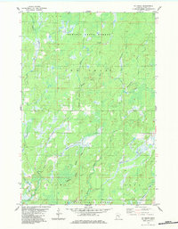
1983 Map of Ox Creek
USGS Topo · Published 1983About this map
The Nemadji State Forest and St Croix State Forest dominate this north-woods landscape, defined by a dense network of waterways and timberland along the Minnesota-Wisconsin border. The survey highlights the remote character of New Dosey, Wilma, and Arna townships during the early 1980s. A complex hydrological system is evident, with the Lower Tamarack River winding through the northwest corner while the Ox Creek and Little Ox Creek drain the southern reaches. The State Boundary Trail provides a rare terrestrial corridor through the marshy terrain, tracing the interstate line. Evidence of local industry is sparse, limited primarily to a Gravel Pit near the southern boundary, reflecting a region primarily dedicated to conservation and state-managed forestry rather than dense settlement or intensive agriculture.
Find a feature on this map
17 named features on this map. Tap any name to fly to it.
Don’t see what you’re looking for? This feature index may not catch every label — zoom into the map to look around manually.
Map Details
Editions of this 1983 Ox Creek Map
This is the sole edition of this map. No revisions or reprints were ever made.
Other maps of this area

1949 · Danbury
USGS Topo · 1:48,000

1949 · Holyoke
USGS Topo · 1:48,000

1953 · Duluth
USGS Topo · 1:250,000

1958 · Duluth
USGS Topo · 1:250,000

1962 · Holyoke
USGS Topo · 1:62,500

1962 · Bruno
USGS Topo · 1:62,500

1962 · Cloverdale
USGS Topo · 1:62,500

1962 · Danbury
USGS Topo · 1:62,500

1980 · Sandstone
USGS Topo · 1:100,000
1981 · Kerrick
USGS Topo · 1:24,000