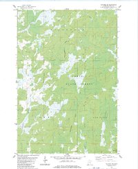
1983 Map of Holyoke SW
USGS Topo · Published 1983About this map
Nemadji State Forest dominates this section of Pine County, Minnesota, during the early 1980s, revealing a landscape defined by its intricate drainage patterns and state-managed woodlands. The terrain is a labyrinth of wetlands and watercourses, including the Net River in the north and the Lower Tamarack River to the south. The presence of the Minnesota-Wisconsin State Boundary running vertically through the center of the quadrangle highlights the remote character of this borderland region. Mapping in New Dosey and surrounding townships shows few signs of permanent settlement, with the land instead dedicated to the Nickerson State Boundary Forest. This survey captures the area just as modern photogrammetric methods were refining the detail of its numerous unnamed ponds and marshes, providing a precise look at the hydrology of the Willow River headwaters before any significant further development.
Find a feature on this map
12 named features on this map. Tap any name to fly to it.
Don’t see what you’re looking for? This feature index may not catch every label — zoom into the map to look around manually.
Map Details
Editions of this 1983 Holyoke SW Map
This is the sole edition of this map. No revisions or reprints were ever made.
Other maps of this area

1949 · Danbury
USGS Topo · 1:48,000

1949 · Holyoke
USGS Topo · 1:48,000

1953 · Duluth
USGS Topo · 1:250,000

1954 · Foxboro
USGS Topo · 1:24,000

1958 · Duluth
USGS Topo · 1:250,000

1962 · Holyoke
USGS Topo · 1:62,500

1962 · Bruno
USGS Topo · 1:62,500

1962 · Cloverdale
USGS Topo · 1:62,500

1962 · Danbury
USGS Topo · 1:62,500

1980 · Sandstone
USGS Topo · 1:100,000