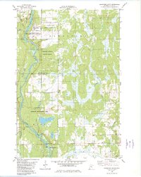
1982 Map of Sandstone South
USGS Topo · Published 1982About this map
The Kettle River carves a dominant path through the center of this Pine County landscape, shaping the development and conservation patterns of the early 1980s. South of the city of Sandstone, the river corridor is preserved through Banning State Park and the Sandstone National Wildlife Refuge, reflecting a significant commitment to public lands and wildlife management. The northern portion of the sheet is marked by institutional and industrial activity, including the Sandstone Federal Correctional Institution and several gravel pits and a quarry near the riverbanks.
Find a feature on this map
29 named features on this map. Tap any name to fly to it.
Don’t see what you’re looking for? This feature index may not catch every label — zoom into the map to look around manually.
Map Details
Editions of this 1982 Sandstone South Map
This is the sole edition of this map. No revisions or reprints were ever made.
Other maps of this area

1950 · Grantsburg
USGS Topo · 1:48,000

1953 · Duluth
USGS Topo · 1:250,000

1953 · Stillwater
USGS Topo · 1:250,000

1955 · Stillwater
USGS Topo · 1:250,000

1958 · Stillwater
USGS Topo · 1:250,000

1958 · Duluth
USGS Topo · 1:250,000

1961 · Sandstone
USGS Topo · 1:62,500

1961 · Pine City
USGS Topo · 1:62,500

1962 · Cloverdale
USGS Topo · 1:62,500

1962 · Grantsburg
USGS Topo · 1:62,500