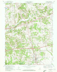
1970 Map of Cloverdale
USGS Topo · Published 1972About this map
The town of Cloverdale serves as the focal point for this southern Putnam County landscape, situated at the junction of the Louisville and Nashville railroad and major highway corridors. The terrain is defined by the winding course of Deer Creek and its many tributaries, including Little Deer Creek and Upper Nashville Creek, which carve through the central townships. The 1970 revision captures the area as Interstate 70 had begun to bisect the countryside, yet it preserves the locations of older rural institutions like the Old Bethel Cem and the South Putnam Sch.
Find a feature on this map
55 named features on this map. Tap any name to fly to it.
Don’t see what you’re looking for? This feature index may not catch every label — zoom into the map to look around manually.
Map Details
Editions of this 1970 Cloverdale Map
3 editions found
Other maps of this area

1949 · Quincy
USGS Topo · 1:24,000

1951 · Clinton Falls
USGS Topo · 1:24,000

1952 · Reelsville
USGS Topo · 1:24,000

1953 · Indianapolis
USGS Topo · 1:250,000

1956 · Indianapolis
USGS Topo · 1:250,000

1956 · Cloverdale
USGS Topo · 1:24,000

1956 · Cataract
USGS Topo · 1:24,000

1956 · Eminence
USGS Topo · 1:24,000

1957 · Indianapolis
USGS Topo · 1:250,000
1957 · Poland
USGS Topo · 1:24,000