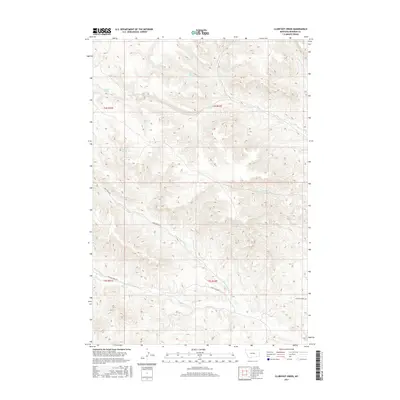
2017 Map of Clubfoot Creek
USGS Topo · Published 2017About this map
Black Eagle Fork and the Saint Johns Fork flow through this section of the Birney District, where the drainage systems of the Rosebud County highlands are meticulously documented. The landscape is defined by its water sources, including family-named landmarks like Elliot Spring, B Heart Spring, and Rondeau Spring, which were vital for ranching and homesteading in this arid part of Montana. Transportation in the early 21st century remains tied to the historical routes of Cook Creek Rd and the Ashland-Birney Rd, which provide access to the remote draws and creek beds. From the headwaters of Clubfoot Cr to the reaches of Mission Cr, the map illustrates a terrain where water rights and access roads dictate the pattern of human presence and land use across the township and range boundaries.
Find a feature on this map
19 named features on this map. Tap any name to fly to it.
Don’t see what you’re looking for? This feature index may not catch every label — zoom into the map to look around manually.
Map Details
Editions of this 2017 Clubfoot Creek Map
This is the sole edition of this map. No revisions or reprints were ever made.
Other maps of this area

1954 · Hardin
USGS Topo · 1:250,000

1957 · Hardin
USGS Topo · 1:250,000

1958 · Hardin
USGS Topo · 1:250,000

1958 · Fisher Butte
USGS Topo · 1:24,000

1958 · Lame Deer
USGS Topo · 1:24,000

1958 · Hollowwood Creek
USGS Topo · 1:24,000

1966 · Browns Mountain
USGS Topo · 1:24,000

1966 · Birney Day School
USGS Topo · 1:24,000

1967 · Clubfoot Creek
USGS Topo · 1:24,000

1967 · Birney
USGS Topo · 1:24,000