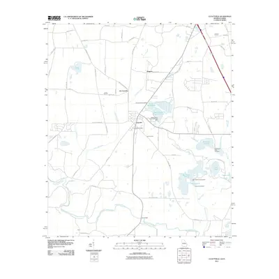
2011 Map of Clyattville
USGS Topo · Published 2011About this map
Old Clyattville and Clyattville anchor this South Georgia landscape, situated just north of the Florida state line where the Withlacoochee River carves a winding path through the swampy lowlands. The geography is defined by a complex network of managed water bodies and natural drainage, including Jumping Gully Creek and Clyatt Mill Creek, which feed into larger features like Whitewater Club Lake and the Owens-Illinois Corporation Lake. This industrial and recreational water management is further evidenced by several structures such as the Owens Illinois Lake Dam and the Bear Garden Swamp Dam.
Find a feature on this map
59 named features on this map. Tap any name to fly to it.
Don’t see what you’re looking for? This feature index may not catch every label — zoom into the map to look around manually.
Map Details
Editions of this 2011 Clyattville Map
This is the sole edition of this map. No revisions or reprints were ever made.
Other maps of this area

1954 · Valdosta
USGS Topo · 1:250,000

1956 · Clyattville
USGS Topo · 1:24,000

1956 · Nankin
USGS Topo · 1:24,000

1956 · Octahatchee
USGS Topo · 1:24,000

1958 · Valdosta
USGS Topo · 1:250,000

1959 · Valdosta
USGS Topo · 1:250,000

1960 · Cherry Lake
USGS Topo · 1:24,000

1960 · Pinetta
USGS Topo · 1:24,000

1961 · Valdosta
USGS Topo · 1:24,000

1961 · Ousley
USGS Topo · 1:24,000