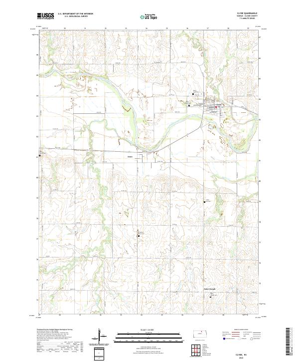
2022 Map of Clyde
USGS Topo · Published 2022About this map
The Republican River meanders across this Cloud County landscape, shaping the development of several distinct rural communities. The town of Clyde serves as the primary hub, showing a structured grid of streets including Broadway St and Washington St, flanked by Mount Hope Cem and Mount Calvary Cem. To the southwest, the smaller settlements of Ames and Saint Joseph are connected by a network of sectional roads like Rust RD and Plum RD. The geography is defined by the drainage patterns of Elm Creek and Beaver Cr, which create the rolling topography between the flat river bottomlands and the upland farms. Genealogy researchers will find significant value in the numerous burial grounds documented here, including Cedar Hill Cem, Walnut Grove Cem, and Pleasant View Cem, which mark the early church and family centers of these farming townships.
Find a feature on this map
78 named features on this map. Tap any name to fly to it.
Don’t see what you’re looking for? This feature index may not catch every label — zoom into the map to look around manually.
Map Details
Editions of this 2022 Clyde Map
This is the sole edition of this map. No revisions or reprints were ever made.
Other maps of this area

1891 · Clay Center
USGS Topo · 1:125,000

1892 · Concordia
USGS Topo · 1:125,000

1892 · Minneapolis
USGS Topo · 1:125,000

1893 · Washington
USGS Topo · 1:125,000

1955 · Manhattan
USGS Topo · 1:250,000

1956 · Manhattan
USGS Topo · 1:250,000

1957 · Manhattan
USGS Topo · 1:250,000

1964 · Miltonvale NE
USGS Topo · 1:24,000

1965 · Clifton
USGS Topo · 1:24,000

1965 · Aurora
USGS Topo · 1:24,000