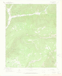
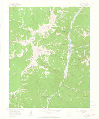
1963 Map of Clyde Lake
USGS Topo · Published 1972About this map
The West Dolores River carves through this high-altitude landscape of the San Juan National Forest, where 1960s land use was defined by isolated ranching and a network of mountain trails. Miller Ranch and Cresto Ranch sit along the river corridor, serving as rare points of human habitation amidst the steep drainages of Schoonhouse Draw and Deadman Draw. High above the river valley, the terrain is marked by distinctive features such as Eagle Peak and the high waters of Clyde Lake, reachable only by a series of Pack Trails and Jeep Trails. Local geography is punctuated by numerous family-named water sources and landmarks, including Cresto Spring and Fivemile Spring, while the southern reaches descend into the vividly named Little Hell Canyon and Big Hell Canyon. The map records a moment when the regional economy was centered on livestock grazing and timber management, evidenced by the scattered reservoirs like Sunshine Reservoir and the Pipe Line crossing the Taylor Mesa area.
Find a feature on this map
36 named features on this map. Tap any name to fly to it.
Don’t see what you’re looking for? This feature index may not catch every label — zoom into the map to look around manually.
Map Details
Editions of this 1963 Clyde Lake Map
4 editions found
Other maps of this area

1897 · Rico
USGS Topo · 1:62,500

1898 · Rico
USGS Topo · 1:62,500

1899 · Rico
USGS Topo · 1:62,500

1953 · Dolores Peak
USGS Topo · 1:24,000

1956 · Cortez
USGS Topo · 1:250,000

1958 · Cortez
USGS Topo · 1:250,000

1959 · Cortez
USGS Topo · 1:250,000
1960 · Rico
USGS Topo · 1:24,000

1962 · Cortez
USGS Topo · 1:250,000

1963 · Stoner
USGS Topo · 1:24,000