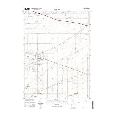
2013 Map of Clyde
USGS Topo · Published 2013About this map
Clyde serves as the central hub of this northern Ohio landscape, where the urban grid of the city meets the productive agricultural plains of Sandusky County. The map documents a deeply rooted rural infrastructure, evidenced by the numerous family and community burial grounds such as McPherson Cem, Ellsworth Cem, and the York Free Chapel Cem. These sites, alongside scattered hamlets like Wales Corners and Colby, reveal a pattern of settlement tied to the drainage of Pickerel Cr and Raccoon Cr.
Find a feature on this map
74 named features on this map. Tap any name to fly to it.
Don’t see what you’re looking for? This feature index may not catch every label — zoom into the map to look around manually.
Map Details
Editions of this 2013 Clyde Map
This is the sole edition of this map. No revisions or reprints were ever made.
Other maps of this area

1901 · Bellevue
USGS Topo · 1:62,500

1901 · Fremont
USGS Topo · 1:62,500

1903 · Bellevue
USGS Topo · 1:62,500

1903 · Fremont
USGS Topo · 1:62,500

1906 · Tiffin
USGS Topo · 1:62,500

1915 · Siam
USGS Topo · 1:62,500

1956 · Toledo
USGS Topo · 1:250,000

1957 · Vickery
USGS Topo · 1:24,000
1957 · Wightmans Grove
USGS Topo · 1:24,000
1958 · Fremont East
USGS Topo · 1:24,000