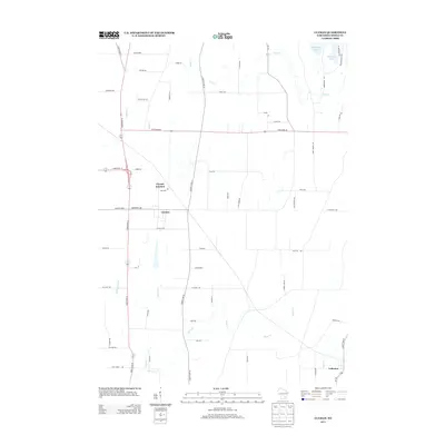
2013 Map of Clyman
USGS Topo · Published 2013About this map
The village of Clyman and nearby Clyman Junction anchor this Dodge County landscape, characterized by a well-defined grid of agricultural roads and winding waterways. The township layout is dictated by the passage of State Road 26 and State Road 60, which intersect near the village center. This area is defined by its drainage patterns, with Clyman Creek and Silver Creek threading through the countryside. In the northeast corner, the shoreline of Sinissippi Lake appears, bordered by a dense network of residential drives including Sinissippi Point Road and Arrowhead Trail. To the southeast, the small settlement of Lebanon sits along the banks of Baker Creek, serving as a secondary local hub. The map provides a detailed view of the rural infrastructure connecting these small communities, from the long stretches of County Hwy-M to established family-named routes like Schoechert Road.
Find a feature on this map
62 named features on this map. Tap any name to fly to it.
Don’t see what you’re looking for? This feature index may not catch every label — zoom into the map to look around manually.
Map Details
Editions of this 2013 Clyman Map
This is the sole edition of this map. No revisions or reprints were ever made.
Other maps of this area

1891 · Waterloo
USGS Topo · 1:62,500

1892 · Watertown
USGS Topo · 1:62,500

1894 · Waterloo
USGS Topo · 1:62,500

1894 · Watertown
USGS Topo · 1:62,500

1910 · Waterloo
USGS Topo · 1:62,500

1955 · Beaver Dam
USGS Topo · 1:62,500

1955 · Horicon
USGS Topo · 1:62,500

1957 · Madison
USGS Topo · 1:250,000
1959 · Richwood
USGS Topo · 1:24,000

1959 · Ixonia
USGS Topo · 1:24,000