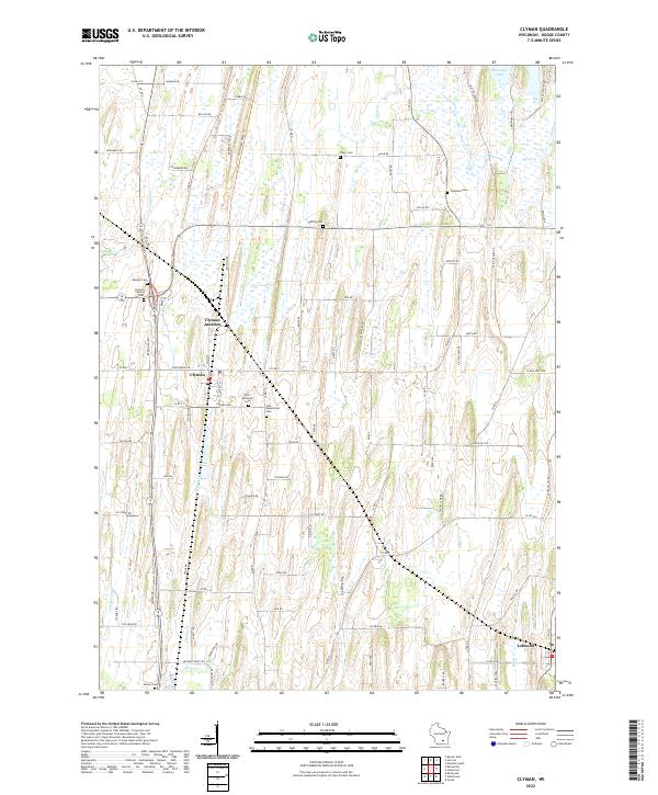
2022 Map of Clyman
USGS Topo · Published 2022About this map
Clyman and Clyman Junction serve as the primary hubs in this section of Dodge County, where the agricultural landscape is divided by a series of north-south waterways. Small family and community burial grounds, including Tabor Cem, Fehling Cem, and Mengel Cem, are scattered across the township, providing essential points of reference for genealogical research. The Wild Goose State Trail follows a former rail corridor north through the terrain, passing near the headwaters of Casper Cr and Dead Cr.
Find a feature on this map
51 named features on this map. Tap any name to fly to it.
Don’t see what you’re looking for? This feature index may not catch every label — zoom into the map to look around manually.
Map Details
Editions of this 2022 Clyman Map
This is the sole edition of this map. No revisions or reprints were ever made.
Other maps of this area

1891 · Waterloo
USGS Topo · 1:62,500

1892 · Watertown
USGS Topo · 1:62,500

1894 · Waterloo
USGS Topo · 1:62,500

1894 · Watertown
USGS Topo · 1:62,500

1910 · Waterloo
USGS Topo · 1:62,500

1955 · Beaver Dam
USGS Topo · 1:62,500

1955 · Horicon
USGS Topo · 1:62,500

1957 · Madison
USGS Topo · 1:250,000
1959 · Richwood
USGS Topo · 1:24,000

1959 · Ixonia
USGS Topo · 1:24,000