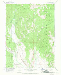
1967 Map of Co-Op Creek
USGS Topo · Published 1969About this map
The Uinta National Forest dominates this landscape, where complex water management infrastructure follows the winding Strawberry River. This 1960s survey documents a network of hydraulic engineering, notably the Siphon and the Currant Creek Feeder Canal, reflecting the intensive water diversion projects characteristic of the era in Wasatch County. The western edge of the map is defined by the Indian Treaty Boundary, a significant historical line separating the national forest lands from tribal territories. Human activity is marked by the presence of the Hub Guard Station and several remote corrals, while the terrain is deeply incised by drainages such as Bjorkman Creek, Co-op Creek, and Shingle Mill Hollow. These features, alongside a scattered network of jeep trails and a local Quarry, illustrate a region transitioning between active natural resource management and mountainous wilderness.
Find a feature on this map
33 named features on this map. Tap any name to fly to it.
Don’t see what you’re looking for? This feature index may not catch every label — zoom into the map to look around manually.
Map Details
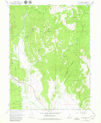
Editions of this 1967 Co-Op Creek Map
2 editions found
Other maps of this area

1885 · Salt Lake
USGS Topo · 1:250,000

1907 · Strawberry Valley
USGS Topo · 1:125,000

1909 · Strawberry Valley
USGS Topo · 1:125,000

1954 · Salt Lake City
USGS Topo · 1:250,000

1958 · Salt Lake City
USGS Topo · 1:250,000

1960 · Salt Lake City
USGS Topo · 1:250,000

1966 · Strawberry Reservoir NW
USGS Topo · 1:24,000
1966 · Strawberry Reservoir NE
USGS Topo · 1:24,000

1967 · Two Tom Hill
USGS Topo · 1:24,000
1967 · Center Creek
USGS Topo · 1:24,000