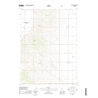
2020 Map of Co-op Spring
USGS Topo · Published 2020About this map
Curlew National Grassland dominates the western portion of this landscape, marking a protected expanse of the high desert along the Idaho border. This 2020 survey illustrates a sparsely populated region of Box Elder County defined by water management and topographic relief. The North Hansel Mountains rise sharply in the center of the sheet, dividing the terrain between the expansive Pocatello Valley to the east and the drainages of Taylor Canyon and Stark Canyon to the north. Resource management is central to the area's layout, seen in the placement of Co-op Spring and the Curlew Valley Reservoir, which provide critical water points in an otherwise arid environment. This map captures the modern rural infrastructure of the basin, where local routes like Ireland Canyon Rd and Allen Rd connect isolated ranching or conservation lands across the state line into Oneida County.
Find a feature on this map
16 named features on this map. Tap any name to fly to it.
Don’t see what you’re looking for? This feature index may not catch every label — zoom into the map to look around manually.
Map Details
Editions of this 2020 Co-op Spring Map
This is the sole edition of this map. No revisions or reprints were ever made.
Other maps of this area

1954 · Pocatello
USGS Topo · 1:250,000

1954 · Brigham City
USGS Topo · 1:250,000

1958 · Pocatello
USGS Topo · 1:250,000

1958 · Brigham City
USGS Topo · 1:250,000

1962 · Brigham City
USGS Topo · 1:250,000

1968 · Ireland Springs
USGS Topo · 1:24,000

1968 · Grover Canyon
USGS Topo · 1:24,000

1968 · Ridgedale Pass
USGS Topo · 1:24,000

1968 · Rattlesnake Pass
USGS Topo · 1:24,000

1968 · Snowville
USGS Topo · 1:24,000