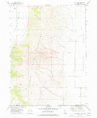
1973 Map of Co-op Spring
USGS Topo · Published 1977About this map
The North Hansel Mountains dominate this high-desert landscape on the border of Oneida County, Idaho, and Box Elder County, Utah. The terrain is defined by its drainages, including Stark Canyon and Taylor Canyon, which cut through the mountain range toward the Curlew Valley to the west and the Pocatello Valley to the east. Evidence of rural land use is scattered throughout the area, notably at Co-op Spring and the Corral sites, indicating the importance of water management and livestock in this arid environment. The map shows a transition from high mountain ridges to broad valleys, interconnected by a network of unimproved roads and a Jeep Trail, illustrating the remote character of the region during the early 1970s. Small, isolated locations such as Lynx and various water tanks provide points of reference for local navigation in this sparsely populated borderland.
Find a feature on this map
13 named features on this map. Tap any name to fly to it.
Don’t see what you’re looking for? This feature index may not catch every label — zoom into the map to look around manually.
Map Details
Editions of this 1973 Co-op Spring Map
This is the sole edition of this map. No revisions or reprints were ever made.
Other maps of this area

1954 · Pocatello
USGS Topo · 1:250,000

1954 · Brigham City
USGS Topo · 1:250,000

1958 · Pocatello
USGS Topo · 1:250,000

1958 · Brigham City
USGS Topo · 1:250,000

1962 · Brigham City
USGS Topo · 1:250,000

1968 · Ireland Springs
USGS Topo · 1:24,000

1968 · Grover Canyon
USGS Topo · 1:24,000

1968 · Ridgedale Pass
USGS Topo · 1:24,000

1968 · Rattlesnake Pass
USGS Topo · 1:24,000

1968 · Snowville
USGS Topo · 1:24,000