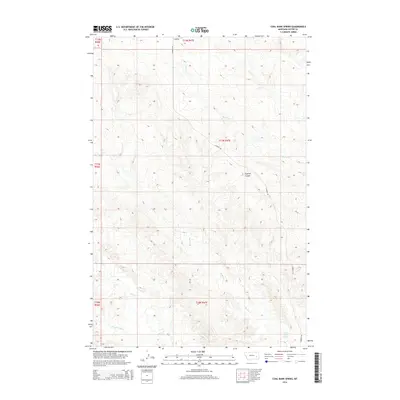
2014 Map of Coal Bank Spring
USGS Topo · Published 2014About this map
Coal Bank Spring serves as a vital water point in this stretch of Custer County, where the high plains of eastern Montana are deeply incised by seasonal drainages. The landscape is defined by the winding course of Muster Cr and Harris Cr, which cut through the terrain alongside the prominent Caprock Coulee. This 2014 survey documents a region primarily organized around ranching and land management, where the Public Land Survey System grid meets the natural flow of the W Fork Sand Cr and Sand Cr. Transportation across these breaks is limited to rural routes like Caprock Rd and Reed Rd, which follow the contours of the high ground between the various creek branches. The map provides a clear picture of the hydrological network and topography that dictates life and movement in this part of the Montana interior.
Find a feature on this map
14 named features on this map. Tap any name to fly to it.
Don’t see what you’re looking for? This feature index may not catch every label — zoom into the map to look around manually.
Map Details
Editions of this 2014 Coal Bank Spring Map
This is the sole edition of this map. No revisions or reprints were ever made.
Other maps of this area

1953 · Miles City
USGS Topo · 1:250,000

1957 · Miles City
USGS Topo · 1:250,000

1958 · Miles City
USGS Topo · 1:250,000

1965 · Twin Buttes School
USGS Topo · 1:24,000

1965 · Morehouse Creek
USGS Topo · 1:24,000

1969 · Horse Creek Hill
USGS Topo · 1:24,000

1969 · Noble Reservoir
USGS Topo · 1:24,000
1969 · Deadman Creek
USGS Topo · 1:24,000
1969 · Coal Bank Spring
USGS Topo · 1:24,000

1969 · Kinsey
USGS Topo · 1:24,000